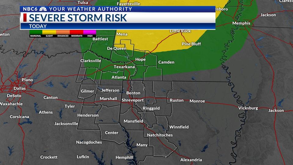
A very warm and breezy afternoon in the ArkLaTex. Temperatures warmed into the 80s for many locations. Winds are gusting up to 25-30 mph. The breezy winds are out ahead of a cold front to arrive late tonight. SPC has a Marginal and Slight Risk out areas along the Interstate 30 corridor. The main threat for this evening will be damaging winds.
As the front continues to push south, it will encounter the moisture in the area and storms will develop. As of now, it remains to be seen how far to the south the storms will form. After sunrise, the line of showers and storms will exit the ArkLaTex. Following the front, clouds will clear and Sunday will be a great afternoon. The upcoming forecast is looking great with plenty of sunshine.
For the second half of the week, daytime highs will warm into the 70s. In the tropics, Tropical Storm Iota in the Caribbean moving towards Central America. Iota is the 30th named storm in the 2020 hurricane season. Iota is expected to become a Category Three before landfall north of Panama. The good news is Iota will remain far away from the Gulf of Mexico.