Our warm and pleasant Fall weather will continue today, and we should enjoy comfortable weather through Saturday. A chance of rain will return late this weekend with cooler air returning early next week.
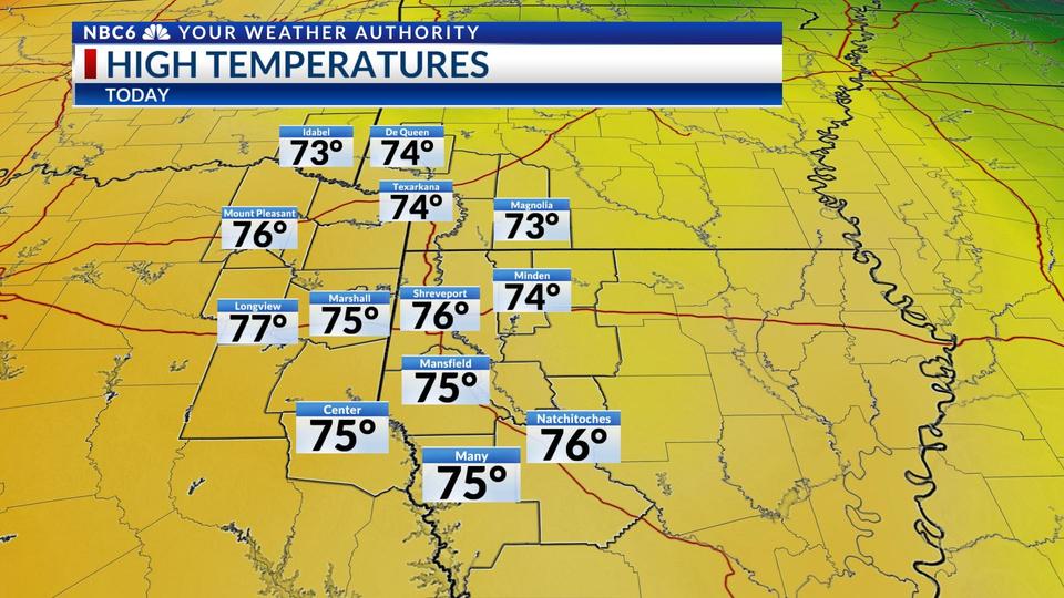
Grab a jacket as you head outside this morning as we are running in the low 40s in most locations, with a few areas expected to drop into the 30s through 8 a.m. A returning south breeze should add a few degrees to our daytime highs which will be comfortably in the mid-70s. Skies will continue to be sunny with a few more clouds tomorrow, Friday, and Saturday.
Our warm and dry Fall weather goes away late this weekend. A cold front will likely move in Sunday, the timing of the rain is still uncertain, but rain is expected to develop across the northern ArkLaTex as the front moves in midday Sunday. A few thunderstorms may be possible later in the day as the front approaches the I-20 corridor, but at this point no severe weather is expected. The arrival time of the front could be later in the day, which would leave most of us dry until late Sunday or early Monday. If you are concerned about any outdoor plans check back for updates.
The Sunday cold front will definitely pack some cooler air. Highs will drop into the 50s and low 60s behind the front Monday with lingering clouds. A second disturbance will bring another chance of rain perhaps late Monday and Tuesday, or Tuesday into early Wednesday. The anticipated rainfall is likely less than an inch when you combine any rain we see Sunday through Wednesday.
The pattern shows signs of drying on Thanksgiving Day with forecast models suggesting we could have highs in the 70s, although at this point rain can’t be completely ruled out. We’ll know more on this in the upcoming days.